Geospatial intelligence for environmental understanding. Foundation models and Earth observation help map how people, ecosystems, and cities interact.
TOPIC 01 / GEOAI
Mapping Cultural Ecosystem Services Using Social Media and Foundation Models
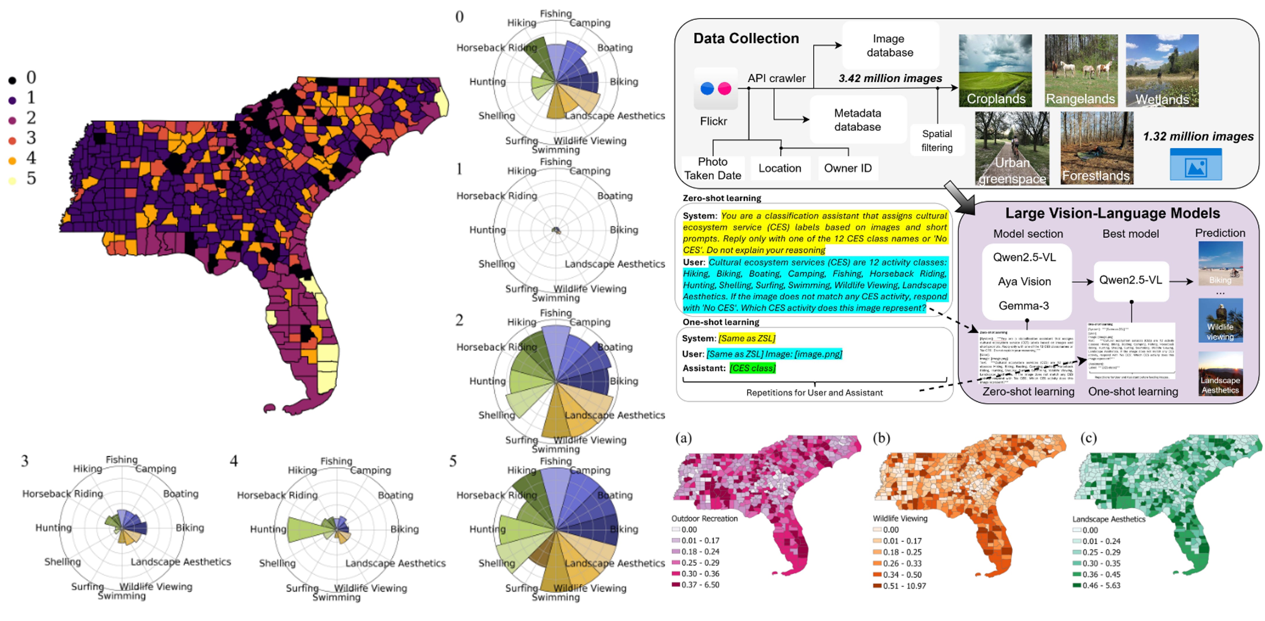
Mapping Cultural Ecosystem Services (CES) flows, including outdoor recreation, wildlife
viewing, and landscape aesthetics, using geotagged social media imagery and
foundation vision–language models (VLMs).
Methods & contributions
Large-scale CES flow analysis:
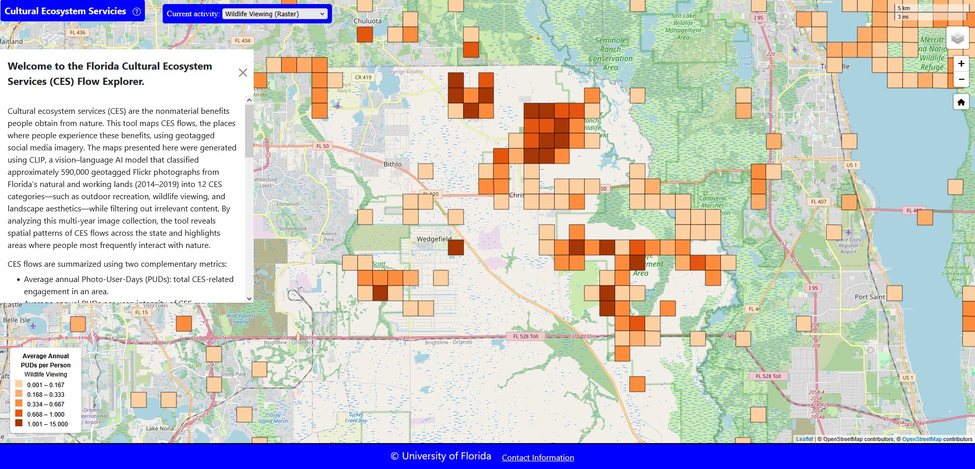
Generated statewide CES maps revealing consistent hotspots along coastal zones, inland greenspaces,
and urban green infrastructure beyond formal park boundaries.
In-context learning with multimodal models:
Applied zero-shot and one-shot learning using large vision–language models (Qwen2.5-VL, Gemma-3, and Aya Vision) on
3.42 million geotagged Flickr images across six southeastern U.S. states, substantially improving
performance with minimal labeling effort.
Flow quantification and CES bundles:
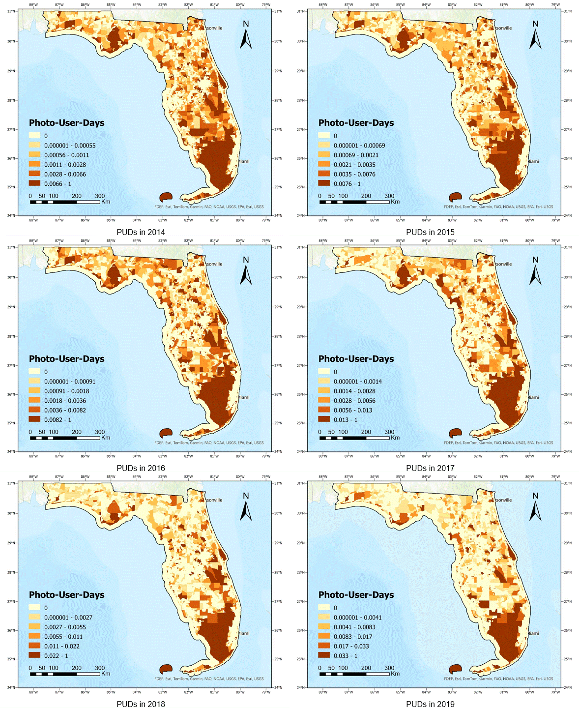
Quantified CES flows using Photo-User-Days (PUDs) and identified spatial CES
bundles aligned with land use and land cover patterns.
This work demonstrates how foundation VLMs, coupled with multimodal LLMs, can overcome
data scarcity and generalization challenges, enabling scalable CES assessment for sustainability
planning and environmental decision-making.
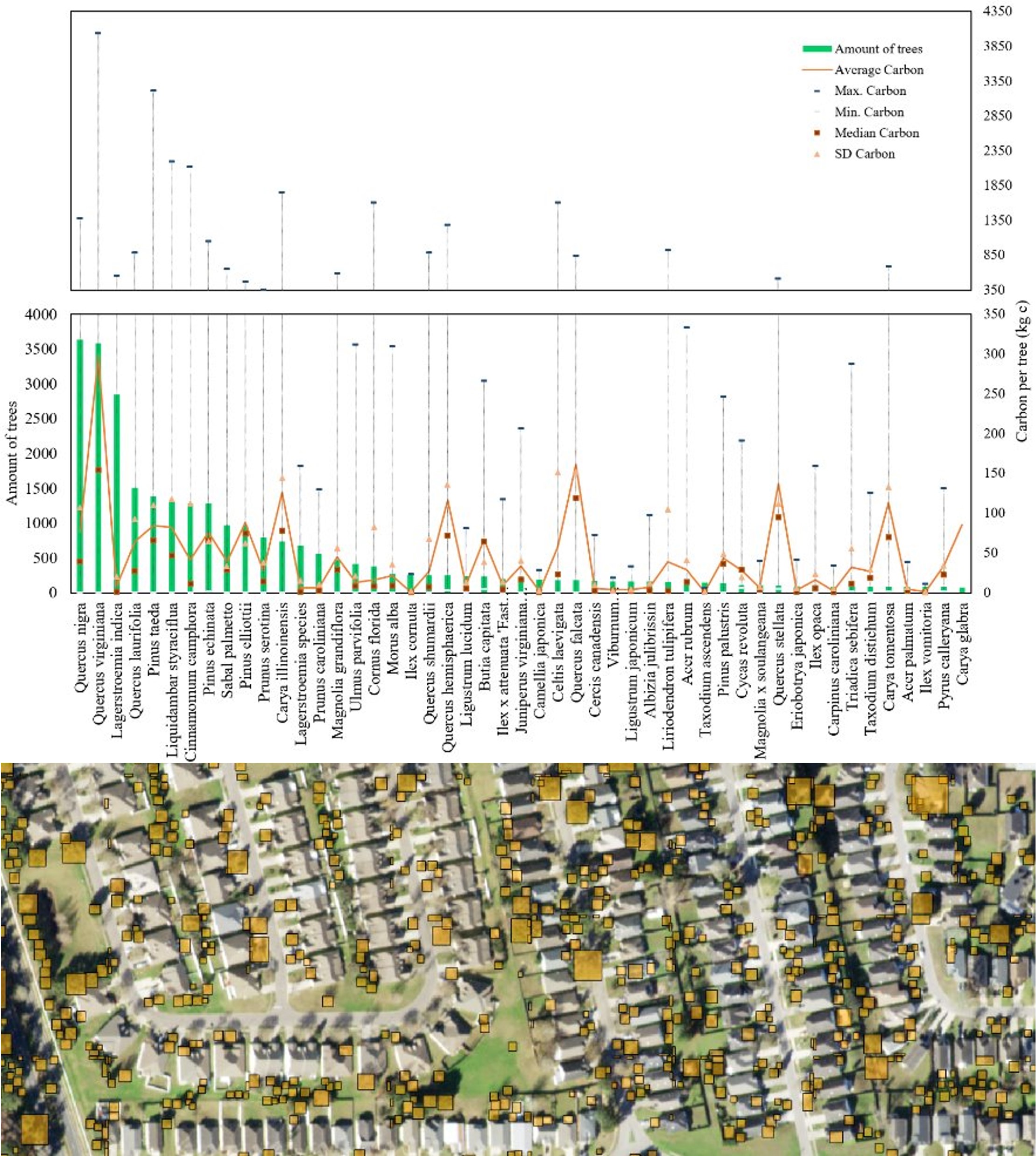
Building end-to-end AI pipelines to detect and monitor individual urban trees from
high-resolution Earth observation data, supporting urban ecosystem accounting and ecosystem services
assessment.
Methods & contributions
Evaluation of tree locations and crown size:
Apply tree-detection AI models (e.g., DeepForest, RF-DETR, HR-SFANet, LangRS) to high-resolution NAIP aerial imagery to derive
point-based tree locations and crown size estimates.
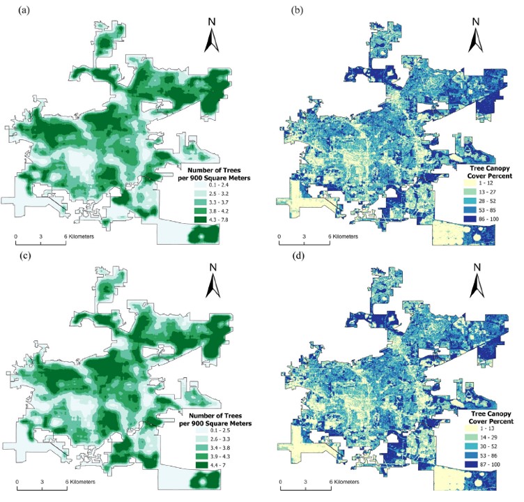
City-scale tree mapping and analysis:
Large-area urban tree mapping with spatiotemporal change analysis and systematic comparison against
external canopy and tree-cover products.
By integrating high-resolution Earth observation data with AI-driven detection and spatial analysis,
this work enables city-scale, repeatable mapping of individual trees and their structural attributes.
Geo-visualization and interactive mapping translate ecosystem service patterns derived
from advanced spatial models into intuitive, web-based visual analytics by building on upstream GeoAI
modeling results and integrating human-centered design principles to support exploration, communication,
and decision-making across diverse use contexts.
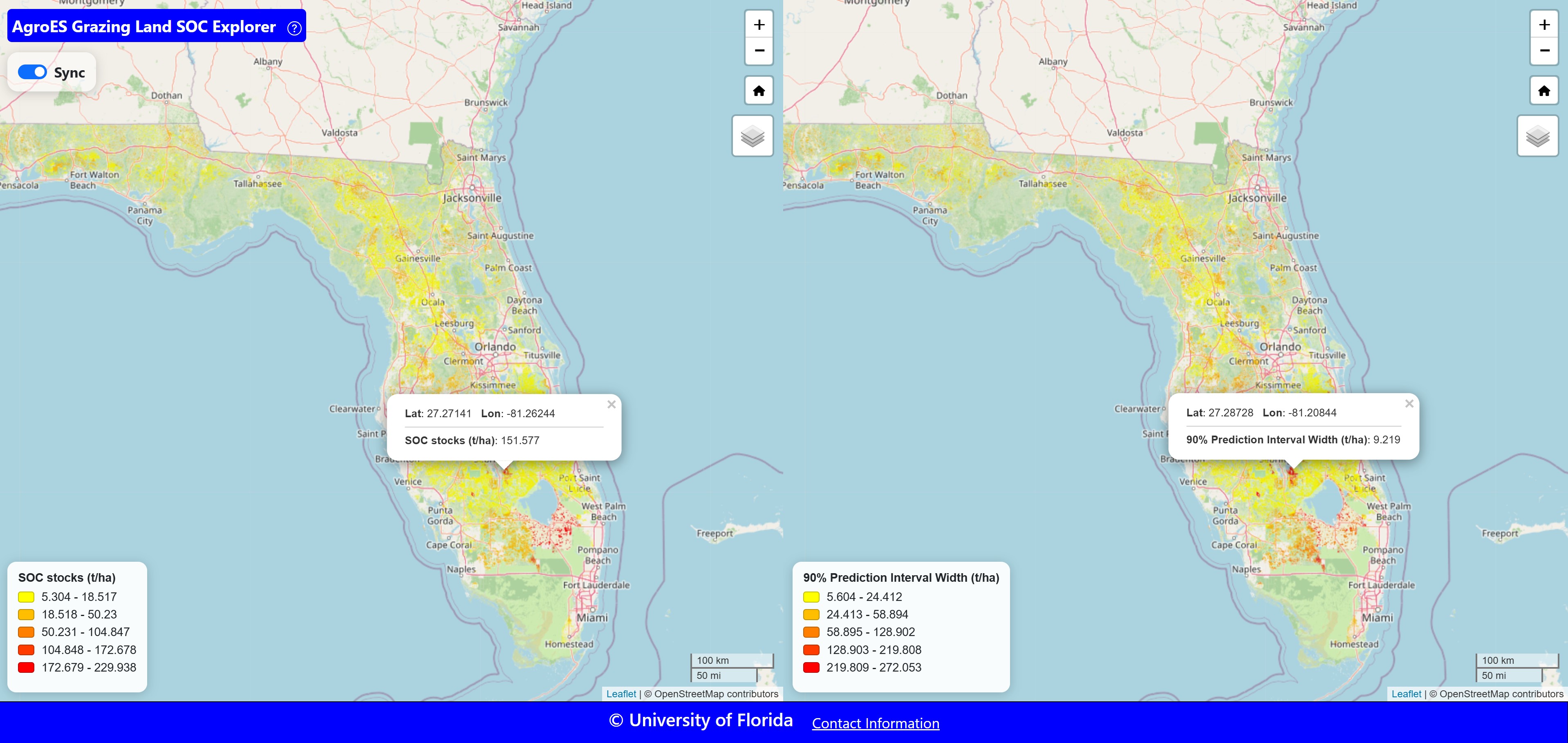
The AgroES Grazing Land SOC Explorer visualizes 30 m soil organic carbon stock predictions and 90% prediction intervals across Florida grazing lands, using synchronized maps to compare estimates and uncertainty.
Methods & contributions
Interactive web-based mapping systems:
Developed responsive geo-web applications that integrate spatial analysis results with interactive
maps, enabling users to explore ecosystem service patterns across multiple spatial scales.
Dynamic visualization of ecosystem service flows:
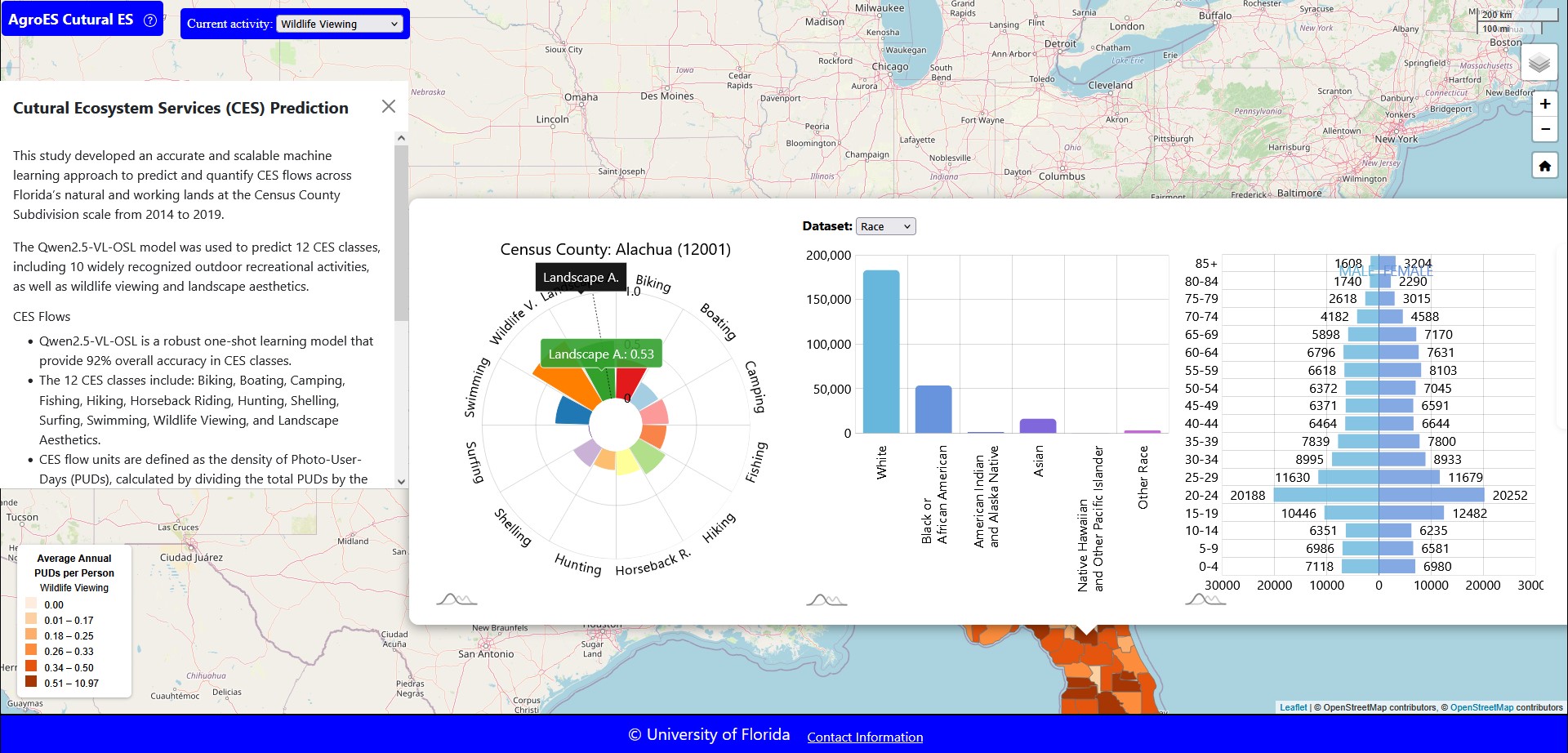
Designed map-based interfaces to visualize the distribution, intensity, and composition of ecosystem
services, supporting the identification of hotspots, gradients, and spatial trade-offs.
Linked spatial and statistical views:
Integrated maps with charts, filters, and dashboards to allow real-time querying, comparison, and
interpretation of ecosystem service indicators.
Scalable and reproducible geo-web architecture:
Implemented modular web-mapping pipelines that support large spatial datasets, reproducible
workflows, and extensibility for future ecosystem service assessments.
These geo-visualization frameworks provide a flexible platform for communicating ecosystem service
information, supporting exploratory analysis, and enabling data-driven decision support across diverse
environmental contexts.